About the Author/Organisation
Brian Douglas, Software Engineer. You can see more of his work by clicking this link.
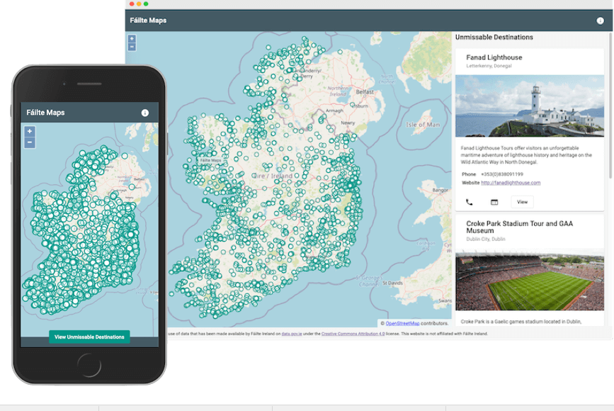
About the Project
This app makes use of data that has been made available by Fáilte Ireland on data.gov.ie under the Creative Commons Attribution 4.0 license.
“For me, it was Fáilte Ireland's data that stood out. I instantly had the idea to take the geo-location information provided and render it on a map of Ireland for all to see. This resulted in the creation of Fáilte Maps”.
Fáilte Maps allows a user to View thousands of attractions, activities, and accommodation across Ireland on a user-friendly map, and can share attractions with friends while also viewing contact details for attractions.
Why it's a Showcase
Fáilte Maps is built with Angular 9 and Firebase, leveraging the seamless integration between them. This framework provided a wealth of tools to streamline development, focusing on the app's functionality. For the map display, Fáilte Maps utilises Open Street Maps, an open-source alternative, along with the Open Layers package. Open Layers facilitated the map integration and functionalities like icons and pop-ups. This technical approach exemplifies the value of Open Data initiatives, as Fáilte Maps transforms publicly available data from Fáilte Ireland (attraction locations) into a user-friendly and interactive map.
Impact of the Showcase
Fáilte Maps empowers users to explore tourism options across Ireland, potentially increasing visitation and economic benefits for the tourism industry. The app also serves as an inspiration for others to explore and utilise open data for innovative purposes.
 Derilinx